About the App
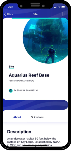
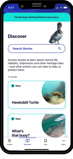
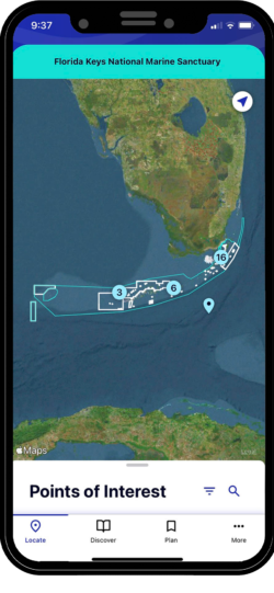
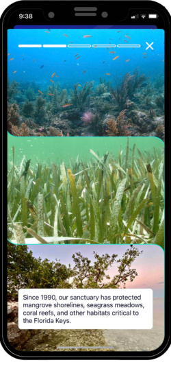
Marine Sanctuary Explorer is your official guide to the protected waters of the Florida Keys, home to the only continental barrier reef in the United States. Allow the app to access your location and the interactive map will alert you to nearby points of interest, with push notifications outlining regulations for each marine zone you enter. Browse the library, where you can learn about plants and animals you’ll observe as you discover the wonders of the sanctuary, and access guidelines that explain how to interact with marine wildlife and habitats safely.
Download for Free:
Review our Mobile App Privacy Policy
About
Marine Sanctuary Explorer is your official guide to the protected waters of the Florida Keys, home to the only continental barrier reef in the United States. Allow the app to access your location and the interactive map will alert you to nearby points of interest, with push notifications outlining regulations for each marine zone you enter. Browse the library, where you can learn about plants and animals you’ll observe as you discover the wonders of the sanctuary, and access guidelines that explain how to interact with marine wildlife and habitats safely/
Review our Mobile App Privacy Policy
FAQ
What kind of information does the app provide?
Photos, descriptions, and coordinates for every zone within FKNMS; Regulatory information relating to zone types; Photos and descriptions for points of interest including coral reefs, shipwrecks, lighthouses, and more; An interactive map with geo-location; Photo stories about common animals found within FKNMS and tips for how to best utilize available resources like mooring buoys.
What kind of mobile device will the app work on?
Both Apple (iOS) and Android. You will have the choice of which free version to download.
How does it work?
Once you download Sanctuary Explorer you simply launch the app and begin use.
Does the app require location information from my mobile device?
If you want to utilize Global Positioning System (GPS) capabilities, the mobile device must grant location access to Marine Sanctuary Explorer.
Is mobile data required for operation of the app?
For highest functionality you should launch the app with mobile data service. Once in use, mobile data is recommended but not required.
What happens when I approach a sanctuary zone?
If you have enabled GPS, the app will notify you when you are approaching a managed zone (i.e. Sanctuary Preservation Area) with details on what activities you can enjoy in that location. It will also suggest additional, nearby points of interest.
Does the app track my location and activities?
Your device will retain this information but it is not transferred externally.
Does that app use my allotment of mobile data?
Only if you are not connected to Wi-Fi.
How does the app help me plan a visit?
You can search by preferred mode for exploring (swimming, diving, snorkeling, boating, boarding or birdwatching) and then bookmark your preferences for later viewing. If you need help getting out on sanctuary waters, you can search our list of Blue Star dive and snorkel operators and fishing guides who are committed to preserving the sanctuary for future generations.
How does this compare with similar products?
Explorer is not a replacement for mobile applications like Fish Rules or the Florida Fish and Wildlife Commission’s Fish/Hunt app, which both have detailed information on fishing regulations.
What if a user experiences an issue with the app?
The “about this app” page provides links for connecting with the sanctuary and Foundation
How does the app help me plan a visit?
You can search by preferred mode for exploring (swimming, diving, snorkeling, boating, boarding or birdwatching) and then bookmark your preferences for later viewing. If you need help getting out on sanctuary waters, you can search our list of Blue Star dive and snorkel operators and fishing guides who are committed to preserving the sanctuary for future generations.
FAQ
What kind of information does the app provide?
Photos, descriptions, and coordinates for every zone within Florida Keys National Marine Sanctuary; regulatory information relating to zone types; photos and descriptions for points of interest including coral reefs, shipwrecks, lighthouses, and more; an interactive map with geo-location; photo stories about common animals found within the sanctuary; and tips for how to best utilize available resources like mooring buoys.
What kind of mobile device will the app work on?
Both Apple (iOS) and Android. You will have the choice of which free version to download.
How does it work?
Once you download Sanctuary Explorer you simply launch the app and begin use.
Does the app require location information from my mobile device?
If you want to utilize Global Positioning System (GPS) capabilities, the mobile device must grant location access to Marine Sanctuary Explorer.
Does the government track my location through this app?
No. NOAA’s National Marine Sanctuaries Program contributes content to this application, but the application is funded, managed, and otherwise controlled by the National Marine Sanctuary Foundation. NOAA does not collect, store, or control any information collected by this application, and the app itself does not collect any personally identifiable information. See the full privacy policy.
Is mobile data required for operation of the app?
For highest functionality you should launch the app with mobile data service. Once in use, mobile data is recommended but not required.
What happens when I approach a sanctuary zone?
If you have enabled GPS, the app will notify you when you are approaching a managed zone (i.e. Sanctuary Preservation Area) with details on what activities you can enjoy in that location. It will also suggest additional, nearby points of interest.
Does the app track my location and activities?
Your device will retain this information but it is not transferred externally.
Does that app use my allotment of mobile data?
Only if you are not connected to Wi-Fi.
How does the app help me plan a visit?
You can search by preferred mode for exploring (swimming, diving, snorkeling, boating, boarding or birdwatching) and then bookmark your preferences for later viewing. If you need help getting out on sanctuary waters, you can search our list of Blue Star dive and snorkel operators and fishing guides who are committed to preserving the sanctuary for future generations.
How does this compare with similar products?
Explorer is not a replacement for mobile applications like Fish Rules or the Florida Fish and Wildlife Commission’s Fish/Hunt app, which both have detailed information on fishing regulations.
What if a user experiences an issue with the app?
The “About This App” page within the app provides links for connecting with the staff of Florida Keys National Marine Sanctuary and the National Marine Sanctuary Foundation. Users may contact floridakeys@noaa.gov or info@marinesanctuary.org.
How does the app help me plan a visit?
You can search by preferred mode for exploring (swimming, diving, snorkeling, boating, boarding or birdwatching) and then bookmark your preferences for later viewing. If you need help getting out on sanctuary waters, you can search our list of Blue Star dive and snorkel operators and fishing guides who are committed to preserving the sanctuary for future generations.
Learn More
Additional Resources
TAKE NOAA's FREE ONLINE
BOATING COURSE
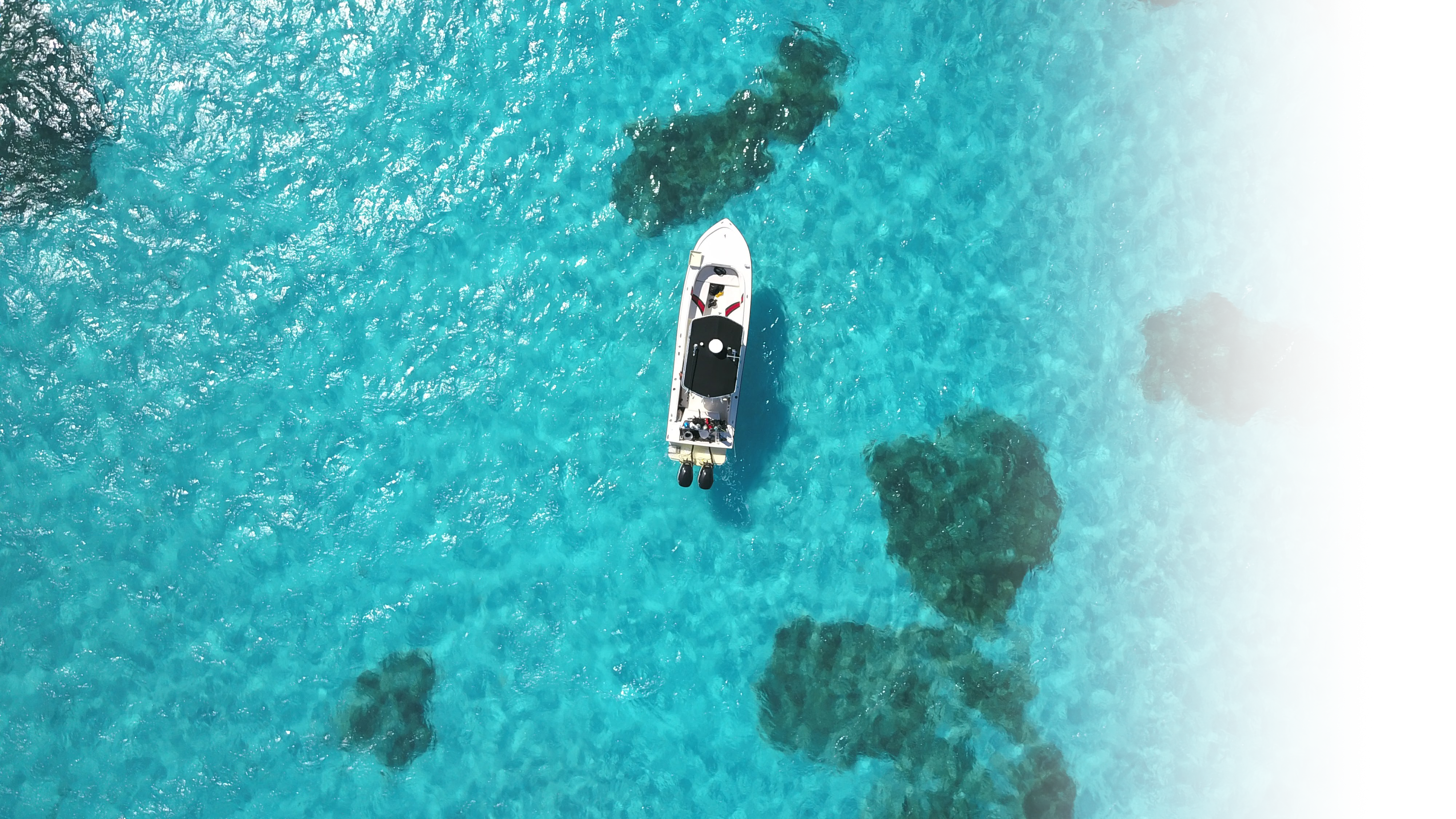
Boaters beware: Florida Keys waters are tricky!
Learn how to protect yourself, your vessel and the unique Florida Keys marine environment through this free online course, available in both English and Spanish.
Additional Resources

TAKE OUR FREE ONLINE
BOATING COURSE
Boaters beware: Florida Keys waters are tricky!
Learn how to protect yourself, your vessel and the unique Florida Keys marine environment through this free online course, available in both English and Spanish.


