Brett Woodworth: From Student Explorer to Ocean Explorer
Land Ho! During the latter part of the expedition, some of the Aleutian Islands became visible from the ship. Many crew members (including myself) went outside to see these volcanic islands. Photo credit: Cassie Ferrante, Mapping Contractor.
By Brett Woodworth, SUNY Geneseo student and NOAA Ocean Exploration Explorer-in-Training Intern
The crystal-clear waters of Lameshur Bay cooled me off as the tropical sun beat down from above. I peeked my head below the water and witnessed an exotic world filled with vibrant fish and graceful stingrays. The view was exhilarating and exploding with life at every turn. As unfamiliar as this world was to me at the time, I felt at home. It was during this school science trip to the U.S. Virgin Islands that I was drawn to ocean exploration, and the experience inspired me to pursue marine biology research as an undergraduate at the State University of New York at Geneseo (SUNY Geneseo).
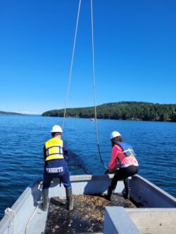
Live in the field! While in the Gerringer Lab, I traveled to Friday Harbor Laboratories in Washington State where we trawled for fish to bring back to the lab for research. Photo credit: Mackenzie Gerringer, Ph.D.
Going into undergraduate studies, I was fascinated by marine biology but did not consider it a career path until I started conducting undergraduate research under Dr. Mackenzie Gerringer, a prominent deep-sea biologist. It was in her lab that I was inspired to pursue a career in deep-sea exploration. One thing I learned early on was that studying deep-sea environments is complicated. The deep sea is difficult to access and it takes an abundance of creativity to figure out how to study various environmental systems, like deep-sea trenches. Dr. Gerringer opened my eyes to the importance of open-access data and how it helps both scientists and students study the deep sea. Open-access data is vital to increasing our knowledge of deep-sea systems by making deep-sea research accessible to all.
In the Gerringer Lab, I worked on many projects focused on investigating the effects that deep-sea environments have on organisms. On one project we investigated the environmental factors that influence the abundance and diversity of deep-sea fish communities, at increasing habitat depth, in the waters off Puerto Rico. We wanted to see if there were any relationships between deep-sea coral community biodiversity and substrate rugosity. You can think of rugosity as the “wrinkling” of the ocean floor. The more rocks and corals there are, the rougher the ocean bottom, which can increase surface area for organisms to inhabit.
This project was funded by the NOAA Ocean Exploration and National Marine Sanctuary Foundation’s Ocean Exploration Education Grants Program. Thanks to NOAA Ocean Exploration’s open-access data, we were able to analyze Remotely Operated Vehicle (ROV) footage collected from the ROV Deep Discoverer aboard the NOAA-operated vessel Okeanos Explorer. During my time working on the project, I gained invaluable experience learning how to fully utilize open-access deep-sea data to conduct both research and outreach. I became proficient in finding open-access videos of interest, analyzing deep-sea footage in software, such as ImageJ and RStudio, and communicating our work to public audiences at scientific conferences. At these conferences, I was not only able to tell fellow scientists about the research we were doing, but I was able to show others the NOAA databases where the data can be extracted for their own future research.
My research experiences in the Gerringer Lab helped me gain confidence as a scientist and researcher. I realized that I could apply my skills and work for an organization, like NOAA, to continue exploring the oceans and make deep-sea data accessible to both classrooms and the public. My work with Dr. Gerringer inspired me to apply and take part in the Explorer-in-Training (EiT) Internship Program through NOAA Ocean Exploration.

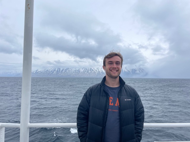
Aboard the Okeanos Explorer! Before departure from Seattle, Washington, I took time to explore around the ship to see everything it had to offer. Photo credit: Lauren Cortez-French
As an EiT, I took part in the Aleutians Deepwater Mapping Expedition (EX2302). The goal of this expedition was to map the seascape of the Aleutian Trench and waters surrounding some of the Aleutian Islands. My time on the Okeanos Explorer was an unforgettable experience. While working on the vessel, it became apparent to me just how much my work on the funded project prepared me for the internship. I was familiar with how to conduct deep-sea research, I knew how NOAA collected data using ROVs and Conductivity, Temperature, and Depth (CTD) instruments, and I learned how to work with a team to collect data. Because of these experiences, I was able to fit right in and get to work with my fellow crew members. The crew made the expedition a welcoming environment and they taught me new, valuable skills in seafloor mapping and hydrography that I am forever grateful for. I learned how to utilize various software to collect and process different types of underwater data, including seafloor, sub-bottom, backscatter, and water column data. Working with the exploration team also introduced me to the career of becoming a mapping contractor, which I am thinking about pursuing.
During my time in the Gerringer Lab and as an EiT, I found that one of the most effective ways to learn was to involve myself in hands-on research. Moving forward, I am excited to continue deep-sea research as a mapping contractor, and provide students with accessible, hands-on deep-sea research experiences by bringing deep-sea science to classrooms. The NOAA Ocean Exploration/National Marine Sanctuary Foundation-funded project, and the EiT Internship, have kickstarted my journey to reach these goals.